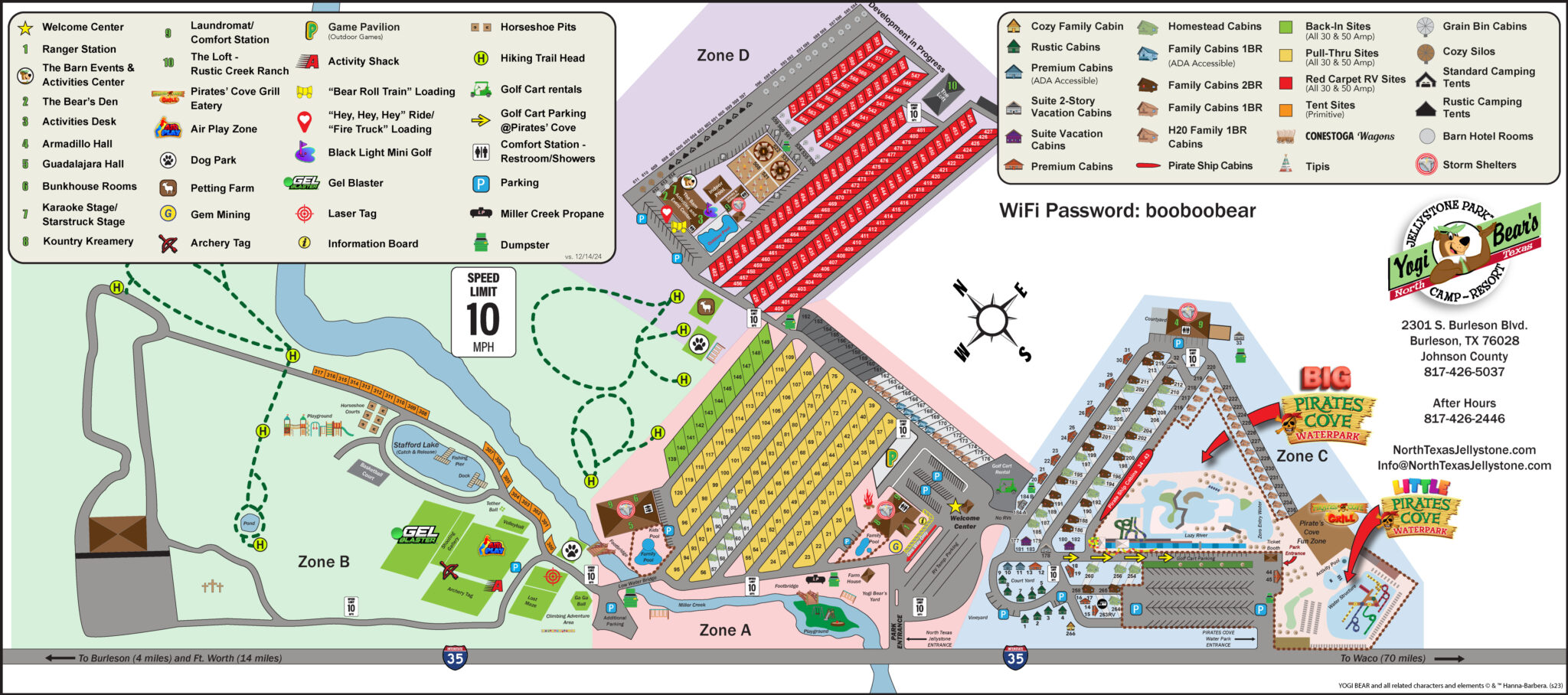
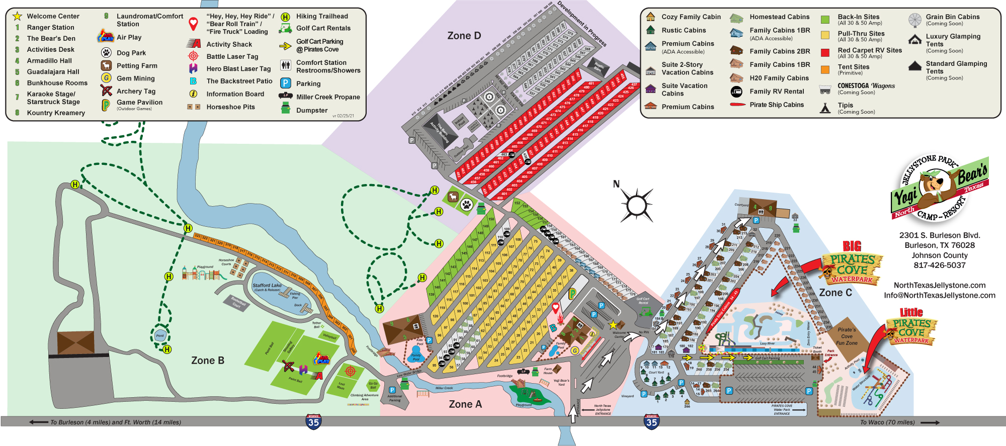
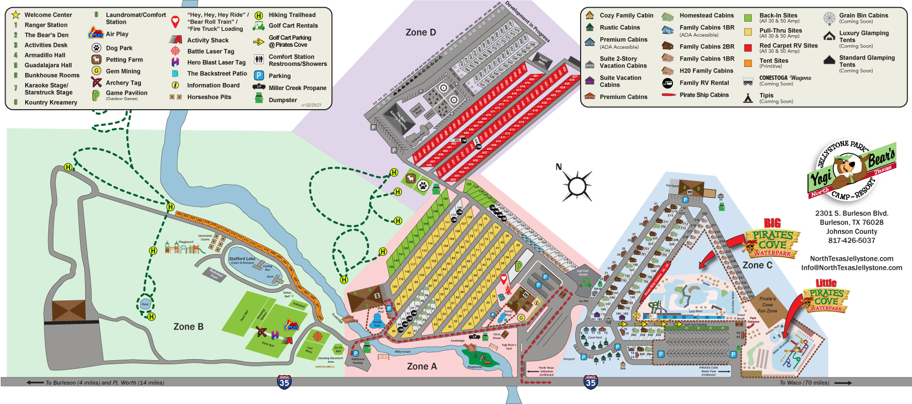
By entering the premises described in the attached Site Map (“Premises”), I hereby consent and authorize Yogi Bear’s Jellystone Park Camp-Resort in Burleson (“Camp-Resort”) and anyone else it may authorize, to film, tape, photograph, or otherwise record me and to use the photographs and/or motion pictures and video taken of me, including my name, likeness and voice, as well as any testimonial statements made by myself, and all other aspects of my personality (“Publicity Items”), and any reproduction of them in any form, for the purpose of publicizing, promoting, and advertising Camp-Resort’s activities in any media now known or later developed, in perpetuity and throughout the world, without further compensation to me. I further agree to release and hold harmless Camp-Resort, its representatives, affiliates, subsidiaries, agents, officers, directors, employees, successors, and assigns, from any and all claims, demands, losses, costs, expenses, or damages, including without limitation reasonable attorney’s fees, which may arise out of or in connection with any claim by me or alleged to be on my behalf resulting from the use of the Publicity Items, the use of which I now knowingly and voluntarily grant to Camp-Resort, and the full ownership rights of which I now knowingly and voluntarily grant and assign to Camp-Resort. Further, I acknowledge and agree that I assume all risks and dangers incidental to the activity of camping in a rustic outdoors environment located on the Premises, including, without limitation, the danger of being injured by insects or other animals, of being injured while participating in recreational activities, such as hiking, swimming, or boating on the Premises, or of being injured as a result of inclement weather conditions (“Risks”). I agree to release and hold harmless Camp-Resort, its representatives, affiliates, subsidiaries, agents, officers, directors, employees, successors, and assigns, from any and all claims, demands, losses, costs, expenses, or damages, including without limitation reasonable attorney’s fees, which may arise out of or in connection with my undertaking of these Risks. Without limiting the generality of the foregoing, I specifically acknowledge that Camp-Resort is not liable for injuries or property damages resulting from such Risks. I represent that I am the parent or legal guardian of any minor children that accompany me, and I hereby consent to the foregoing on his/her behalf. If you do not wish to agree to these terms, then you should not enter the Premises. TM & © Hannah Barbera (522)